Principal Freight Network
The Principal Freight Network (PFN) is a framework that identifies and protects Victoria’s key road and rail freight routes and places. The PFN’s strategic network facilitates the efficient, sustainable and economic movement of freight to support Victoria’s economic prosperity and liveability.
On this page
- Identifying and protecting road and rail freight routes and places
- The review
- Next steps
- Frequently asked questions
Identifying and protecting road and rail freight routes and places
The Principal Freight Network (PFN) is an important framework that identifies and protects Victoria’s key road and rail freight routes and places.
It includes freight corridors and places of national, state and regional significance that support high-capacity and efficient freight movements around Victoria.
By creating the new PFN, we’re identifying needs for now and into the future, taking a strategic approach to reserving rail and road corridors and key sites to support growth in the freight industry.
In 2020, we undertook a review of the PFN and it is now complete.
The PFN will enable the future growth of the freight task on the Victorian transport network by:
- Guiding future transport network and land use planning and infrastructure investment to ensure consideration and prioritisation of freight
- Protecting the Principal Freight Network and future capacity of this network through appropriate legislation, planning scheme and policy provisions, and
- Integrating multi-modal supply chains and end-to-end supply chains to achieve productivity gains and industry competitiveness.
The PFN gives certainty to industry and communities on the preferred routes for freight movements, and significant freight places now and in the future to support land-use planning.
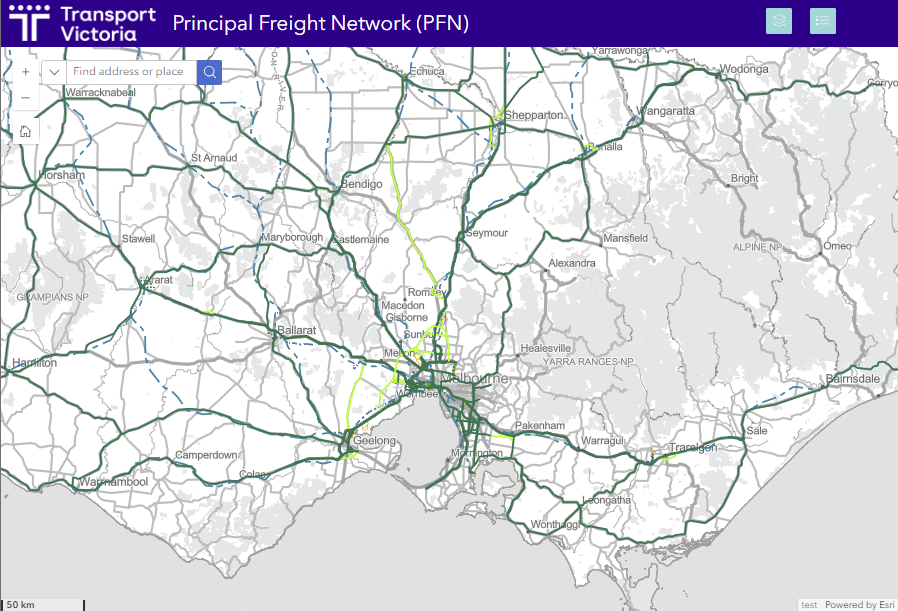
The review
 (opens in a new window)
View a larger version of the map(opens in a new window)
We undertook a thorough review of the PFN using an assessment framework and criteria. We sought feedback from local government and industry to ensure the PFN maps are accurate and reflect the appropriate freight places and corridors.
Last reviewed in 2013, the PFN was established more than ten years ago.
It has now been updated to capture changes in population, land use, new freight places and transport projects that are under construction or have been delivered which change the way people and freight move around the transport network.
We are now also increasing the protection of the PFN to include key freight places and precincts as well as the transport corridors that connect them through the gazettal of the PFN within the planning scheme.
Next steps
The PFN is recognised as part of the State Transport System in Clause 18: Transport of the Victorian Planning Provisions.
It must be considered by responsible authorities in decision-making. Incorporated documents can only be amended by the Minister through a planning scheme amendment process.
Frequently asked questions
Open all
- What is the Principal Freight Network (PFN)?
The PFN is the strategic network of current and recognised future freight places and connecting movement corridors that are of national, state or regional significance and accommodate freight of significant volume, value or importance.
It facilitates the efficient, safe, sustainable and economic movement of freight in Victoria, both now and in the future.
The PFN does not define vehicle size/mass requirements and infrastructure standards for roads. Trucks can use roads that are included and excluded from the PFN consistent with current practice, and the various regulations that apply to the use of the road network.
- Why do we need the PFN?
The purpose of the PFN is to facilitate the efficient, safe, sustainable, and economic movement of freight in Victoria and enable future growth of the freight task on the Victorian transport network.
It gives certainty to industry and communities on the preferred routes for freight movements, and significant freight places now and in the future.
It will guide future transport network and land use planning and infrastructure investment to ensure consideration and prioritisation of freight.
The PFN reflects the integration of multi-modal and end-to-end supply chains to achieve productivity gains and industry competitiveness. These freight supply chains need to be protected from encroachment of sensitive land uses.
- How is the PFN different to other freight networks?
The PFN is distinctive to other networks, including:
- Freight Vehicle Capable Networks: such as High Productivity Freight Vehicle and B-double networks. Only the parts of these networks that meet the criteria are included in the PFN.
- Over Size Over Mass (OSOM) networks have been created because the movement of a particular good/commodity or particular vehicle is temporary/single use. For more information on heavy vehicle map networks, please visit VicRoads website(opens in a new window).
- What was used to define the PFN?
An assessment framework was developed by the Department of Transport and Planning (DTP) to assist in identifying the principles and criteria for selecting freight places and corridors for the PFN.
Key guiding principles and steps include:
Step 1: Determine economic significance by identifying freight places
| Criteria | Application |
|---|---|
| Identified as being of national, state or regional significance in Victorian Government strategies or policies | Transport gateways and state-significant industrial precincts from Plan Melbourne Significant freight places from Regional Growth Plan |
| Supports increased use of rail for freight purposes | Various metropolitan and regional road/rail intermodal terminals |
| Handles (or is likely to handle) high or regionally significant freight volumes | Major regional sea/airports and road/rail intermodal terminals Strategic extractive resources areas identified in the extractive resources strategy Considers other high freight generating uses such as: Industrial land Extractive industry interest areas Plantations Isolated places of regional significance such as waste transfer stations |
| Step 2: Determine connectivity by identifying potential freight corridors. |
| Criteria | Application |
|---|---|
| Connects nationally significant freight corridors | Roads on key national freight routes and secondary freight routes identified by the Australian Government |
| Provides the primary route for the movement of goods across Victoria (i.e. through movement function) | All freeways, interstate and township connections Includes at least one declared road connection between freight places and other high freight generating uses Existing and future freight rail networks used for through purposes |
| Provides an important connection to freight places or between transport modes (i.e. access function) | Declared roads (or likely future declared roads) that provide strategic access to, through or near freight places and other high freight generating uses Only includes local roads that are likely to be future declared roads or a suitable declared road does not exist connecting Freight Places, especially around major gateways. All local spur lines and private sidings that provide access to identified freight places |
| Step 3: Determine capacity and efficiency by refining the network of freight corridors to best meet all criteria |
| Criteria | Application |
|---|---|
| Carries a high volume of freight and/or a high frequency of freight vehicles | Roads that carry significant truck volumes on a regular basis and meet other criteria (connectivity, capacity and efficiency) Rail lines that carry freight trains on a regular or seasonal basis |
| Carries high productivity freight vehicles (HPFV) and high mass vehicles | Recognises the benefits of HPFV and expanding the HPFV network Roads on the HPFV network that meet other criteria (connectivity, capacity and efficiency) Corridors in the current HPFV networks and to be assessed for future expansion |
| Provides capacity for existing freight demand and/or future growth of the freight task | Includes road and rail corridors with capacity to accommodate existing and future freight demands Corridors that have both through and access function |
| Provides for timely and/or reliable freight movement | Considers factors affecting travel time and 24/7 availability Corridors that are most effective and no alternative is available Roads consistent with the objective of promoting the development of industrial and other high freight generating uses along the PFN |
| Minimises transport network conflicts | No interaction with tramways Corridors with minimum conflict with strategic and current public transport and cycling corridors |
| Minimises land use and amenity conflicts | Corridors without any major activity centres |
- What types of projects are included in the PFN?
The PFN reflects current and planned future freight places and corridors and is aligned to the announced major projects being fully delivered. It is considered a long-term, strategic network.
However, further PFN reviews may be made in the future as new projects are committed or developed.
- If a road is now on the PFN, does it mean that it will be upgraded?
No, the network will not change as part of this update. However, if a new proposal for development along a PFN corridor is planned, a developer will need to ensure that it considers the needs of freight adequately.
The PFN may be used in the future to help guide prioritisation of investment for freight movements along particular corridors. The inclusion of a freight place or corridor on the PFN does not reflect a commitment by Government to funding.
- If a road corridor is now on the PFN, does that mean there will be more trucks traveling on it in the future?
Not necessarily, however, these corridors will reflect the preferred freight corridors and will be protected through the changes to the VPP from inappropriate developments, ensuring that the corridors maintain freight vehicle access.
- What changes will be made to the PFN following the construction and opening of new roads?
Various changes will need to be made to the PFN following the construction and opening of these new roads, including the replacement of some roads with incompatible land uses with the new roads. These are clearly identified on the PFN Maps as “committed future removals".
- Does the PFN include any changes to current road and rail infrastructure?
The PFN project does not include any changes to current road and rail infrastructure. Inclusion on the PFN does not imply any commitment by the Victorian Government to fund any new or upgraded corridors and places.
- Are local roads included in the PFN?
Local roads are only included if they are likely to be future declared roads or provide better alternative truck route, or a suitable declared road does not exist connecting Freight Places especially adjacent to the major gateways (ports and airports).
- How will the PFN be protected?
Without the PFN, freight movements around the transport network will continue, but with less confidence around adjacent land use and corridor protection, both now and into the future, so the PFN will be protected from both a strategic and statutory perspective.
It is available on the DTP website to ensure that all stakeholders are able to understand where the network is and use it to make informed decisions for future development and even business locations.
Updated 12 November 2024
About the VIC Government
- The Premier and ministers
- Find a Vic Gov department, agency or service
- Strategies and policies
- Inquiries and royal commissions
Grants and programs
Jobs and careers
Arts, culture and heritage
Business and the workplace
- Mentally Healthy Workplaces Framework
- Portable Long Service Authority
- Victoria’s racing industry
- Workforce Inspectorate Victoria
- Liquor licensing, sale and supply
Communities
- Children
- First Peoples - State Relations
- Finding records
- Gender equality & women’s leadership
- LGBTIQA+ equality
- Multicultural communities
- Seniors Online
- Veterans support and commemoration
- Volunteering in Victoria
- Youth Central
Education and training
- Victorian Early Childhood Regulatory Authority
- Early childhood education – information for professionals
- Kinder: Best Start, Best Life
- Education – information for parents
- Schools.Vic - information for schools
- Education grants, programs, awards and events
- PROTECT
- TAFE, training and universities sector
- TAFE Victoria
- Victorian Skills Authority
- Apprenticeships Victoria
- Learn Local
Environment, water and energy
Finance and economy
Health and social support
- Family violence reform
- NDIS Worker Screening Check
- NDIS and disability services and support in Victoria
- Patient Review Panel
- Transforming Trauma Victoria
Housing and property
Law and justice
- Adoption
- Births, deaths and marriages
- Honorary justices
- Machete ban
- Safeguarding Victorians against terrorism
- Stolen Generations Reparations Package
- Victims of Crime
- Victorian Racing Tribunal
Safety and emergencies
- Emergency Recovery Victoria
- Victorian Emergency Relief and Recovery Foundation
- Emergency Recovery Resource Portal
- How well do you know fire
- Fire Services Reform
- Water safety
- Marine Search and Rescue
Science and technology
- Data sharing and open data
- Data.vic - discover and access Vic Gov open data
- Developer.Vic - portal for API developers
- Go.vic URL shortener
- Vic Gov IT project dashboard
- Victoria’s free public wi-fi network
- Cyber security in the Victorian Government
Sport and recreation
Traffic and transport
- Cameras Save Lives
- Transport Fines
- Getting Around
- Transport Planning
- Transport Future
- Climate Change and transport
- Future Directions For Transport
- Transport projects
- Ports and Freight
Working in the Victorian Government
- Single Digital Presence home
- Accommodation and Library Services
- Executive employment in the Victorian public sector
- Budget, procurement and funding
- Careers in the Victorian Government
- Council and Regulator Toolkit
- Guidelines for working in government
- Join a government network
- Standards and guidelines
- VicFleet CarPool
- Victorian Government style guide